Elemento
Viral Spread: A Snapshot of Kansas Coronavirus Cases
Título (Dublin Core)
Viral Spread: A Snapshot of Kansas Coronavirus Cases
Description (Dublin Core)
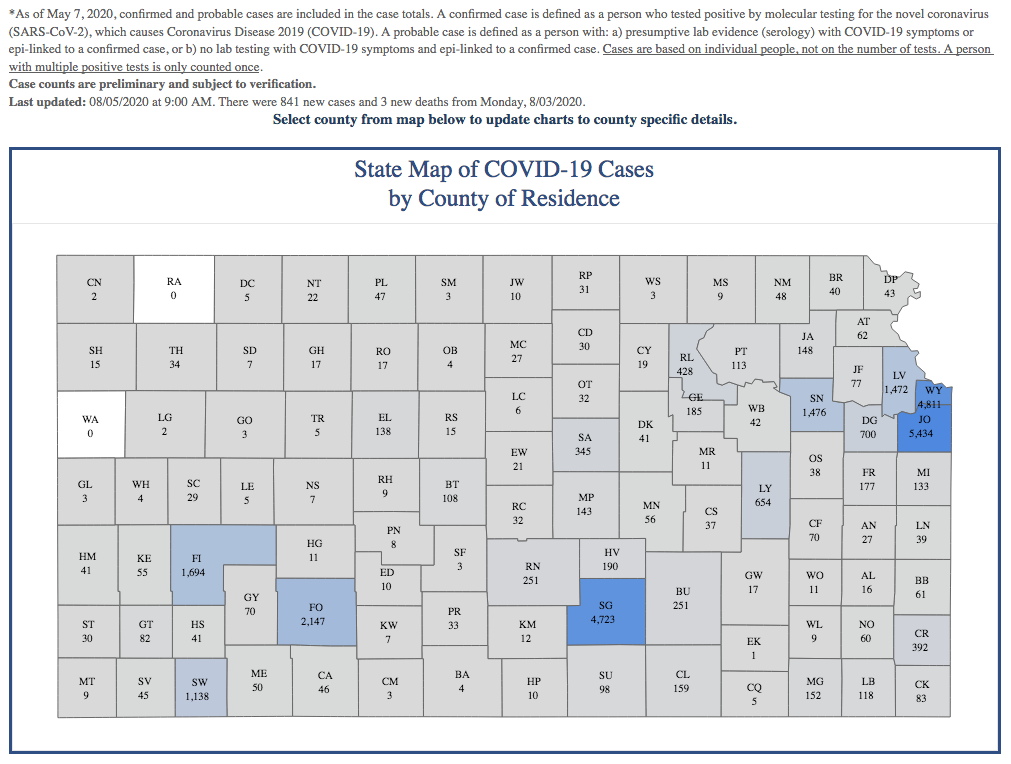
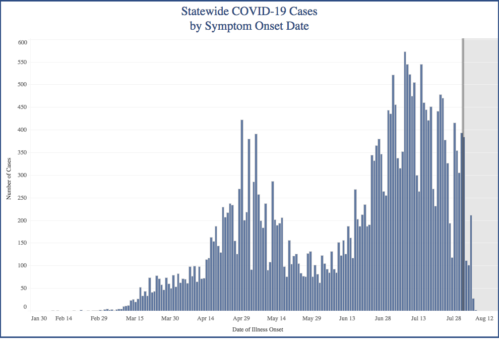
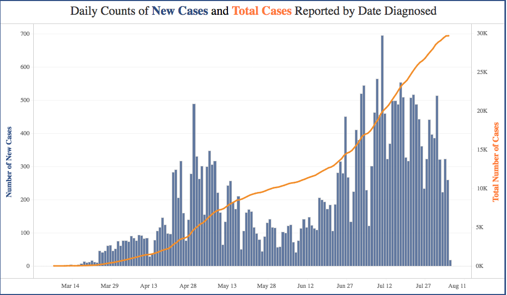
This screenshot taken on August 5, 2020, captures the virus's spread in the state of Kansas as of that date, with Johnson and Wyandotte Counties ("JO" and "WY"/Kansas City, KS, metro-area), along with Sedgwick County ("SG"/Wichita), leading the state in total number of cases. The two graphs depict the virus's course throughout the spring and summer of 2020, revealing its early rise, decline, and accelerated summer surge. Together, these screenshots offer a snapshot of the effects of a patchwork response and quick reopening, and how quickly virus cases spread as a result.
Date (Dublin Core)
August 5, 2020
Creator (Dublin Core)
Kansas Department of Health and Environment
Contributor (Dublin Core)
Aaron Peterka
Partner (Dublin Core)
Northeastern University
Tipo (Dublin Core)
Screenshot
Link (Bibliographic Ontology)
Controlled Vocabulary (Dublin Core)
English
Government State
English
Healthcare
English
Science
English
Social Distance
English
Health & Wellness
Curator's Tags (Omeka Classic)
health
Kansas
Kansas Department of Health and Environment
statistics
map
Collection (Dublin Core)
Healthcare
Environment
Linked Data (Dublin Core)

Date Submitted (Dublin Core)
08/05/2020
Date Modified (Dublin Core)
08/15/2020
11/03/2020
04/02/2021
Colecciones
This item was submitted on August 5, 2020 by Aaron Peterka using the form “Share Your Story” on the site “A Journal of the Plague Year”: https://covid-19archive.org/s/archive
Click here to view the collected data.