Item
Hourly AQI Sacramento Region Thursday, July 22
Title (Dublin Core)
Hourly AQI Sacramento Region Thursday, July 22
Description (Dublin Core)
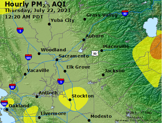
This is an animated map of air quality in the Sacramento, CA region on Thursday, July 22, 2021. The map shows the air quality in the region every twenty minutes during the day. From roughly 8:00 AM to 10:00 AM, Camp Wolfeboro is located in the "unhealthy" air quality index level. From 7:00 AM to 12:00 noon the air quality is "unhealthy for sensitive groups". The poor air quality in the region appears to originate in Alpine County based on the animation, the location of the Tamarack Fire.
Date (Dublin Core)
Creator (Dublin Core)
Contributor (Dublin Core)
Type (Dublin Core)
URI
.gif
Link (Bibliographic Ontology)
Controlled Vocabulary (Dublin Core)
Curator's Tags (Omeka Classic)
Contributor's Tags (a true folksonomy) (Friend of a Friend)
Collection (Dublin Core)
Date Submitted (Dublin Core)
08/15/2021
Date Modified (Dublin Core)
08/15/2021
Date Created (Dublin Core)
07/23/2021
Item sets
This item was submitted on August 15, 2021 by Nicholas Harvey using the form “Share Your Story” on the site “A Journal of the Plague Year”: https://covid-19archive.org/s/archive
Click here to view the collected data.